GNSS NETWORK
NIEP is using GNSS technology since 1996 with measurements in a temporary GPS network of 58 points. In 2001 NIEP installed the first permanent station in collaboration with the Faculty of Geology and Geophysics – University of Bucharest (FGG), Delft University of Technology, the University of Utrecht and the Netherlands Research Center for Integrated Solid Earth Sciences (ISES) for the study of crustal deformation. Nowadays the network of reference stations includes 24 stations (Figure 1). NIEP has an outstanding previous experience relevant to the project tasks especially in ground based monitoring (seismic, geodetic - GPS and geophysical fields) and data acquisition, real time transmission, processing, analyzing and interpreting using advanced mathematical, physical, geophysical and IT knowledge.
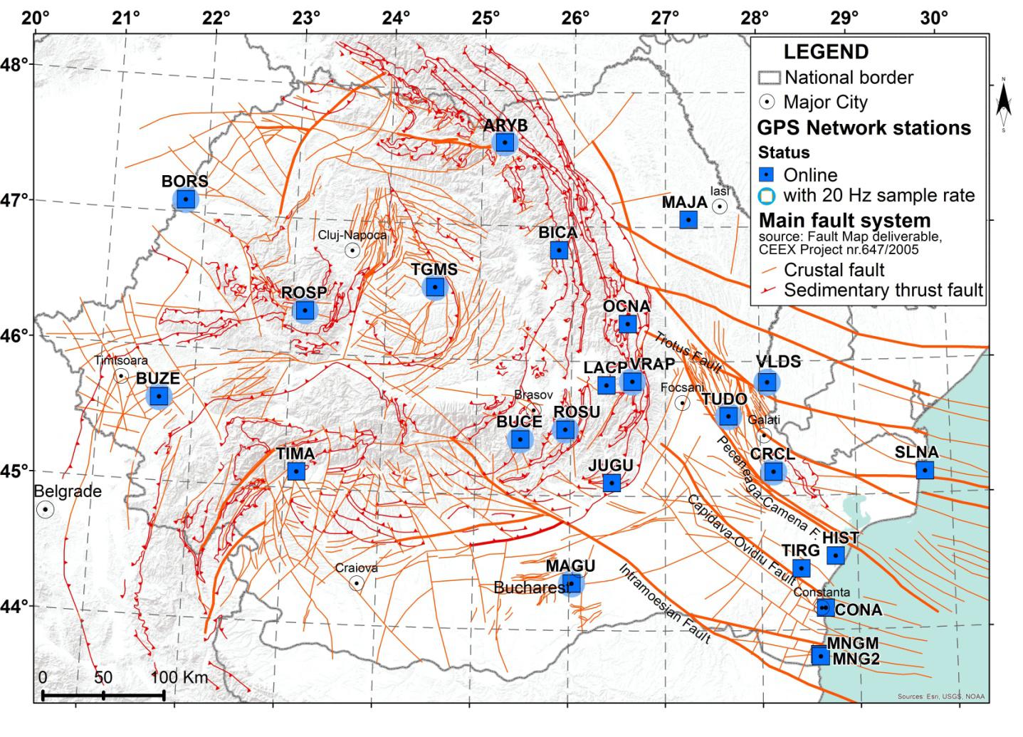 Figure 1
In Dobrogea, the first GPS permanent station installed was Histria (HIST) in 2003 and recently the network increased to 7 permanent stations. These seven permanent stations are maintained in the present by the National Institute for Earth Physics.
Another network developed in this region is GeoPontica network (Figure 2), developed and maintained by National Reasearch and Development Institute for Marine Geology and Geoecology in 2013. GeoPontica (represented by 18 ground settlement stations) provides data from the West side of the Black Sea geodetic networks – both in Romania and Bulgaria concerning: the vertical movements of the Earth’s Crust (isostasy, elevation, land subsidence, basining etc.).
Between NIEP and GeoEcomar there is a collaboration regarding GPS data exchange.
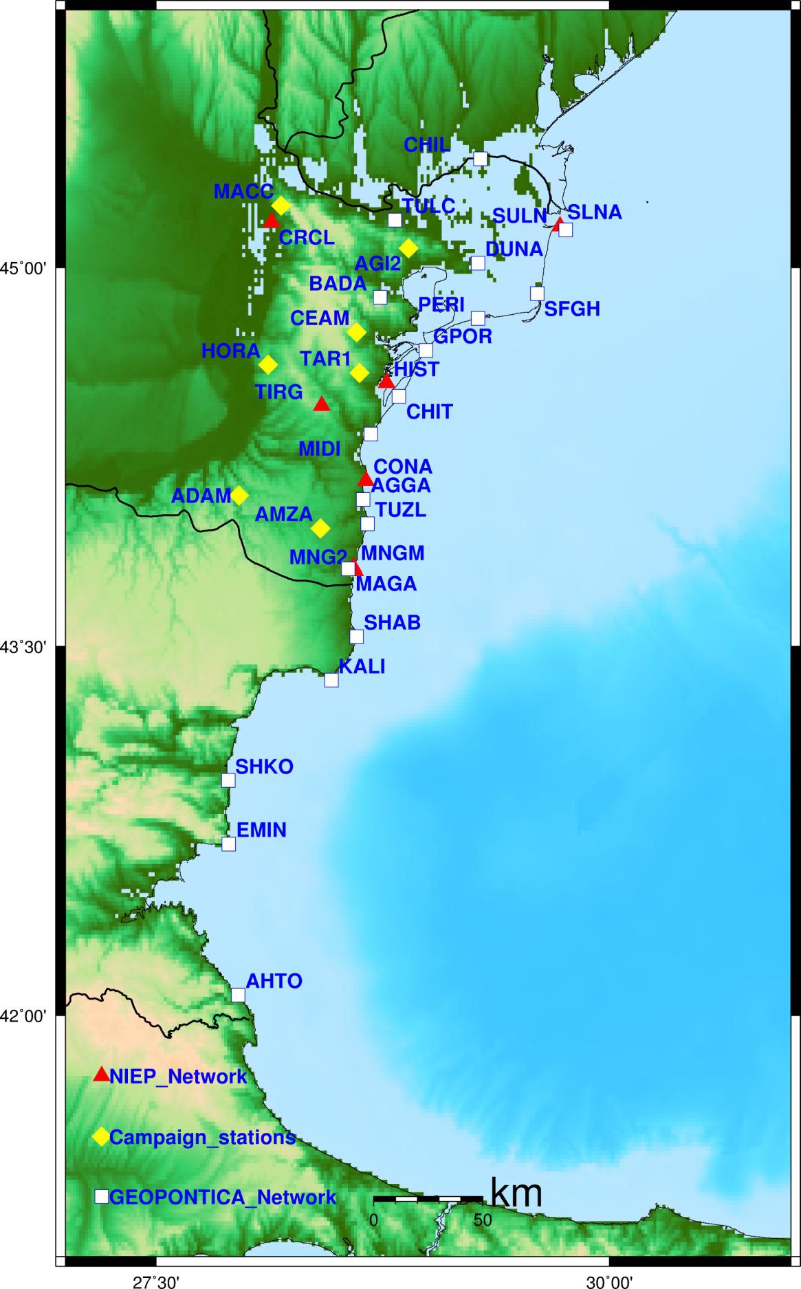 Figure 2
The NIEP GPS/GNSS permanent stations have mixed equipment. A vast majority of them being equipments produced by Leica Company: GR10, GRX1200GGPro, SR 530 and the GRX1200 + GNSS receivers type and antenna models used are LEIAT504, LEIAR10 and LEIAX1202GG. We also operate 2 stations with Septentrio equipment with AseRx2e HDC receivers and PolaNt-x MF anntenas. In the present, NIEP has two top Leica GR30 receivers available for two new permanent stations and two mobile GNSS sets of equipment dedicated for field campaigns. The GeoEcoMar GPS permanent stations are equipped with Topcon receivers and antennas.
Data acquisition is achieved in real time, in RAW DATA format nd RINEX format, using Leica GNSS Spider and Septentrio Rx software. Furthermore, 11 of the network’s stations simultaneously record Ring Buffer data on receiver’s internal memory at a rate of 20 Hz. (0.05s).
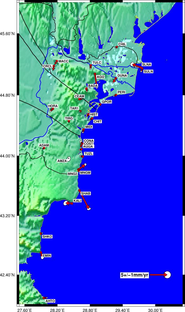
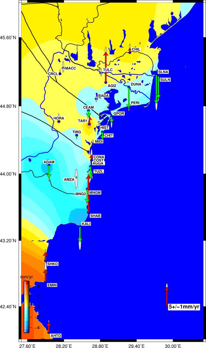
The results of the Dobrogea tectonic activity shown in plots, indicate that the ESE part of the Romanian territory gets away in respect to the stable Eurasia, velocity values reaching no more than 2.5 – 3.0 mm/y (Figure 2).
Acknowledgements.
We thank the National Reasearch and Development Institute for Marine Geology and Geoecolog, National Center for Monitoring and Alarm to Natural Marine Hazards – Euxinus, for providing access to their data.